Saturday, October 31, 2015

McClellanville, SC - Day 35

Day 35
10/26/15


McClellenville, SC is a very small town of 300 people. The economy here depends primarily on shrimping and fishing. The marina here is basically a commercial fishing and fuel dock that also accepts transient boats for overnight stays. It was conveniently located between Myrtle Beach and Charleston, so we stopped for the night.


There is not much in McClellanville, but we did walk a couple of blocks to the seafood market along a street lined with beautiful Spanish moss-draped live oaks. There we bought some very nice shrimp just off the boat for $6.99 a pound. If you wanted smaller shrimp you could pay $4.99 a pound. We bought three pounds of the large shrimp, some to freeze for later and some to eat right away. The local restaurant was closed, so we had steamed shrimp for dinner. I'm glad we thought to stock our pantry with Old Bay! We went to bed with storms in the area and more predicted for the following day, so we went to bed we were thinking we would be stuck here eating shrimp for the next two days. It could be worse!

Wednesday, October 28, 2015

Time Off From Boating Again - Day 21 through Day 34

Day 21-34
10/12/15 through 10/25/15

The flooding in the Myrtle Beach area had may boats holding in marinas waiting for the water to recede, especially sail boats that were unable to get under bridges due to the high water.  The Osprey Marina was jam packed.  We spent a couple of days at the marina cleaning the boat and getting it ready for our week and a half away.


 Before driving to Culpeper, VA to watch our grandchildren, we decided to spend a few days in Myrtle Beach since neither of us had ever been there.


Jake and Kimi loved the beach.  In the evening when the beach was relatively empty I would throw their water toys in the ocean for them and they had a blast swimming and retrieving.


One day there was a wedding on the beach.


We walked out on the fishing pier at our hotel and saw a number of large sharks under the pier where people were cleaning the fish they had caught.  We decided not to swim in the ocean since these were only a couple of hundred yards from our beach!  All in all we decided that we liked Ocean City, MD, where we have spent many summers, a lot better.


After Myrtle Beach, we drove to Culpeper and spent the week driving two of our granddaughters to and from school and various other activities while our son Michael and our daughter-in-law Maureen were at a veterinary conference in upstate New York.  One day I drove to Baltimore and back in order to see my orthopedic surgeon and get a shot in my knee.  One day Jake and Kimi went to Michael's veterinary clinic and got caught up on various shots and had their teeth cleaned.  The last day when Michael and Maureen got home we went to Maureen's birthday party where Michael had hired Maureen's favorite band from Ocean City, "Scott's New Band", to play, and had the party catered by a local Italian restaurant.  About 80 people showed up for an evening of music, dancing, good food, and an open bar.  Michael throws the best parties in Culpeper!

My brother David and sister-in-law Terri drove up from New Bern for the party


Sharon and I with our son Michael.


Maureen having "Happy Birthday" sung to her by Scott's New Band.


Our three lovely granddaughters, Rebecca, Emily, and Elaine at their mom's party.


After the party, we drove halfway back to Myrtle Beach and then finished the journey to the Osprey Marina the next day to pick up the boat and continue on our adventure.  

One tip for other boaters, when you leave the boat for a week and a half, don't accidentally turn off the shore power breakers.  You'll come back to a refrigerator and freezer full of bad food.


Monday, October 12, 2015

Flooding in South Carolina - Day 20

Day 20
10/11/15

When we left Southport, NC this morning it was COLD!  We bundled up with sweatshirts and long pants for the first time on the trip.  A cold front had passed during the night and the day was cloudy and cold until late in the afternoon


We crossed into South Carolina and began to see very tropical looking houses along the waterway as well as trees with Spanish moss hanging from them.


As we arrived in the North Myrtle Beach area we began to see large fishing yachts and this floating casino.


The farther along the waterway we went the more and more we saw flooding of houses and properties.  The Waccamaw River, toward which we were heading, was experiencing extreme flooding due to last week's torrential rains in South Carolina and the high water was also affecting the waterway.  The good thing for us was that the high water made our passage through the infamous "Rock Pile" section of the waterway near Myrtle Beach a non-event.  Since the residential properties along this section were so flooded the Coast Guard had instituted a LOOOONG no wake zone to avoid further damage to houses and property.  We spent hours at no wake speed, so our passage to our next stop took a lot longer than anticipated.


Below is the sign at the turn to our marina, luckily all of the docks there are floating docks, so the marina itself was basically unaffected by the high water.


This will be the last blog post for a few days.  We plan to leave the boat here while we explore Myrtle Beach and then drive up to Virginia to spend some time with grandchildren.  Hopefully when we get back the river flooding will have subsided and we can move on without worrying about flood debris in the water.


Saturday, October 10, 2015

To Southport, NC with Just a Quick Side Trip - Day 18 & 19

10/9/15 - 10/10/15
Day 18 & 19


While studying the map for our route this morning I realized that there was a drawbridge about 15 miles from us that would only open on the hour.  It was 7:45 am and I knew we would have to leave within 15 minutes in order to make the 9:00 am opening, otherwise it would be 10:00 am before we could get through.  We hurried our departure and found ourselves in the middle of a sailboat and slow trawler southbound brigade.  Since we had to slow to pass each boat we didn't keep up our usual cruising speed.  We were still able to make the opening with only a minute or two to spare by spending about 15 minutes at full throttle which added about 5 mph to our usual cruising speed.


Along the way we passed some very nice houses and boats.  Through this section we started seeing many more private docks with floating docks since the tidal range in this is about 5 feet.


Finally, we made it to the Cape Fear River and open water again.  It felt wonderful to be able to relax and use the autopilot again, which I couldn't do in "the ditch".


This is the "Old Baldy" lighthouse on Bald Head Island and is the oldest lighthouse still standing in North Carolina.


We were just cruising along and enjoying the sights and the open water.  After passing Old Baldy, I mentioned to Sharon that the water was really getting wide here.


I had just been following the green markers and our cruising guide said that the turn to Southport was at Green #1, so I was looking for that.  When I saw how wide the water was I double checked and realized that even though we were not at Green #1 yet we had missed the turn to Southport and were actually about a mile past the line marking the mouth of the Cape Fear River, which meant we were in the Atlantic Ocean!   Here is a screen shot of our track, the red triangle is our boat at Southport, the yellow line is our track out into the ocean and back.


Finally, we reached Southport Marina, which is a really nice marina.  Kimi had gotten so hyper during the trip she had to be sedated, so she slept through the side trip.


We walked around the town a little and found that they really like Halloween here.


We saw a number of old houses, most of the nicest ones were on the waterfront and belonged to river pilots who guided large ships into the Cape Fear River and into port.  They made very good money and often would only take payment in gold, so they could afford the best properties in town.


We had a pretty sunset at the marina.


Since the next day's weather was predicted to be thunderstorms all day we decided to stay put and not travel.  We also wanted to see a little more of Southport.  We took a golf cart guided tour of the town and were shown all of the sites where Under The Dome, Safe Haven, and Matlock were filmed.  We were also told a number of tales of the town's history and how important is was during the civil war.  We also visited the town museum and the mariner's museum where we could look through an actual submarine periscope that went through the roof of the building and view various sights around the town and on the water.

This boat was in the parking lot of our marina.


We visited an old jail house.


 Learned he history of the pineapple.


Saw the church that was used in filming Under the Dome - this is the church where the steeple fell into the street in the TV show.


We visited the Old Smithfield (Southport's original name) Burying Ground, apparently to check up on some possible relatives.


Our first day here we stopped at this restaurant for a lunch of shrimp and crab cakes.  Today the place was jam packed.  We learned that it had just reopened yesterday after it was flooded after the recent rains and Joaquin storm surge.  We also learned that they don't make their crab cakes anything like we are used to in Maryland and Virginia.


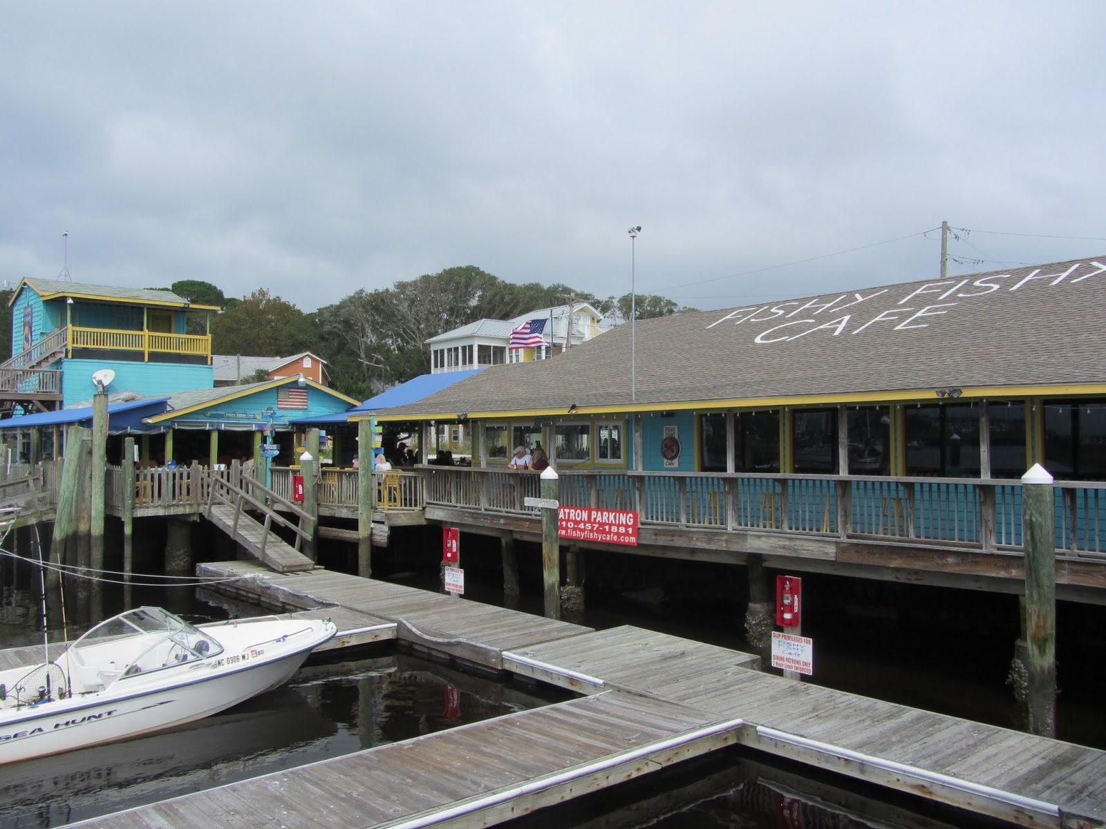
We ate instead at Fishy Fishy, another  place used in the filming of Safe Haven.  The food was great, we had tuna and grouper.


On the way back to the boat I spotted this egret lounging in his easy chair.


Thunderstorms started about mid-afternoon and continued into the evening.  We attended Mass at the local Catholic church and called it a day with dinner on the boat.  Hopefully, we can move on to Myrtle Beach tomorrow.

Thursday, October 8, 2015

There Are Two Kinds of Boaters on the ICW - Day 17

10/8/15
Day 17

What are the two kinds of ICW boaters?  1. Those who have run aground and  2. Those who lie about running aground.  What kind am I?  I'm not a liar.

Upon leaving Beaufort, NC this morning only about a mile from the marina I became confused with all of the markers for our channel, the Beaufort Inlet, and the ICW continuing south.  Heading for the wrong marker I came softly aground.  As soon as the boat stopped our following wake lifted the boat and propelled it even further into the shallows, so then I could not reverse back out of the shallow spot and into deeper water.  I was not worried about the running gear since the PDQ Powercat is designed to be "beachable" without harming the propellers or rudders.  However, since the engines use sea water for cooling, I shut off the engines to avoid causing any damage to the impellers or cooling system by sucking up mud and sand.  The good news was that our newly repaired depth sounder continued to read depths all the way down to 2.2 feet.  If only I had noticed sooner!

Each year I pay about $200.00 to be a member of BoatUS, and the membership includes unlimited towing.  It's a great bargain since I think it costs about $200.00 just to talk to a tow boat on the phone.  Luckily, it only took BoatUS about 15 minutes to respond, with two boats no less, and the young men and their dog soon had us back in deep water and on our way.  Sharon tipped the dog with some dog treats and he was very appreciative.  Seriously, the tow would have cost far more than our membership, so if you boat, especially on the ICW or the Chesapeake Bay, you really should join BoatUS!


After our slow start, we continued south on the ICw in a narrow channel through the very shallow Bogue Sound.  For the first time I truly understand why people refer to the ICW as "The Ditch".  It certainly takes concentration to stay in the channel.  Along the way we saw a Naval Amphibious Transport Ship with an MV-22 Osprey flying above.  The Osprey is cool because it can take off and land vertically like a helicopter but can fly like an airplane.


We also saw a pod of dolphins very close to the boat feeding in the shallow waters of the Bogue Sound.


We discovered a 2.9-acre private island with a small house for sale.  Retirement property anyone?


We also passed through a 4-mile section of the ICW near Camp Lejeune, the largest Marine Corps base on the east coast, where they practice live fire of artillery and other weapons.  Luckily today was a day off.  Just for the record we came upon another boat aground in this section of the waterway, but he was able to get off by himself just after we had passed him.


While waiting for a low bridge to open so we could continue, we discovered that we are definitely part of the "snowbird" migration south on the ICW.


A few miles after Camp Lejeune we stopped for the night at a marina near the New River Inlet where we were told that their fixed docks had been underwater through yesterday and this was the first time in days the water had gone down, so our timing was perfect.  We'll see what tomorrow brings as we head for Southport, NC.  Our planned marina there has floating docks so high water should not be an issue, but we have been hearing reports that there is a lot of debris in the waters along the ICW due to the recent flooding, so we may have to travel slowly.

Since our marina for tonight is in the middle of nowhere, we just had dinner and a relaxing evening on the boat.